Why Aren’t Weather Forecasts Always Accurate?
Checking the weather is one of modern society's most ingrained daily rituals. We glance at our smartphones before going to sleep to prepare for the morning commute, strike up casual conversations about impending rain with strangers at coffee shops, and invest considerable time and money organizing weekend sports outings, family road trips, and outdoor picnics around meteorological projections. When an unexpected downpour washes out an afternoon baseball game, public frustration almost always lands directly on the local television meteorologist. Viewers expect pinpoint accuracy in every aspect of life, and weather reporting is no exception.
Yet holding meteorologists personally responsible for unexpected atmospheric shifts overlooks the extraordinary scientific complexity behind modern predictions. Long gone are the 1950s, when viewers had no 24-hour weather television networks and had to mail handwritten letters of complaint or shout heckles across the street—a dynamic famously satirized by Nicolas Cage in the 2005 film The Weather Man. Modern forecasters do not rely on subjective guesswork or individual hunches; they synthesize immense amounts of computational data generated by advanced supercomputers to evaluate conditions across fluid, rapidly evolving global systems.
Key takeaways
- Weather projections looking 24 hours ahead feature high reliability because atmospheric pressure systems and frontal boundaries are already well-formed and actively tracking.
- Projections extending beyond five days, particularly those spanning 10 to 14 days, are rough estimates heavily influenced by historical calendar averages rather than real-time physics.
- Local news forecasters do not calculate models from scratch; they interpret complex outputs generated by specialized supercomputers, such as those maintained by the National Weather Service.
- Regional topography and microclimates drastically alter forecasting accuracy, making stable coastal regions far easier to model than flat, wind-swept plains prone to violent temperature swings.
The computational engine behind modern atmospheric modeling
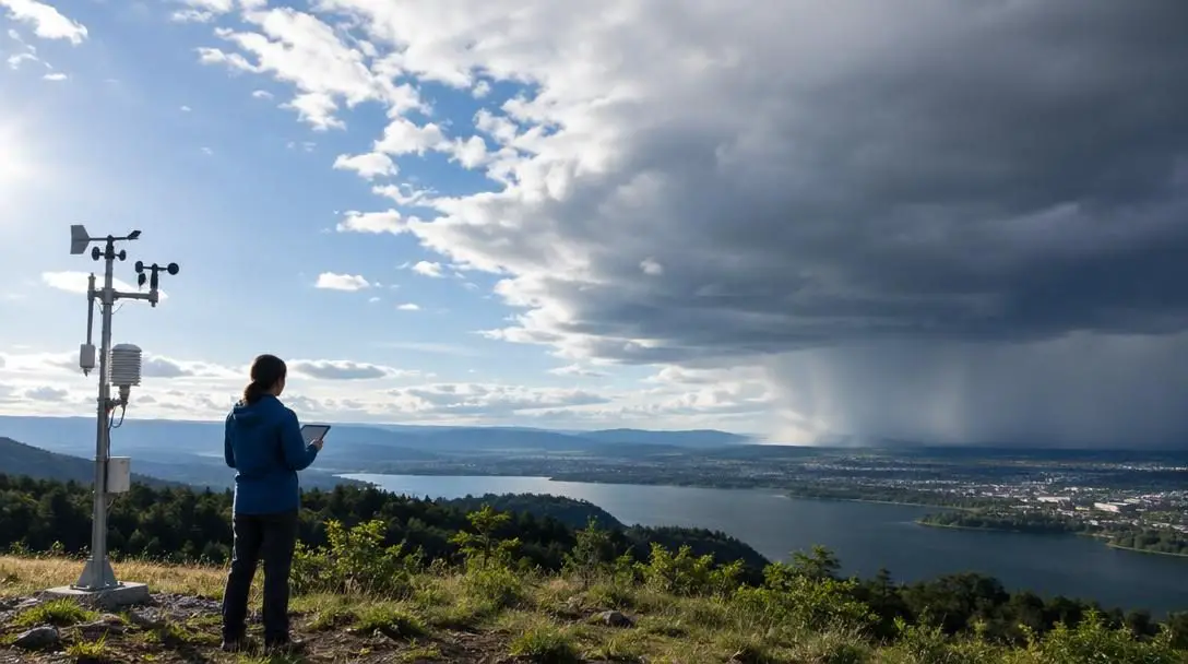
Modern weather forecasting is fundamentally an exercise in supercomputing and mathematical simulation. The forecasters on your local news broadcast are not sitting at a desk estimating storm paths based on intuition. Instead, they act as analytical communicators who evaluate complex guidance produced by multiple computerized atmospheric models. Weather centers across the United States operate several distinct mathematical simulations, comparing their calculations to identify where different equations agree and where they diverge.
To run these colossal simulations, agencies such as the National Weather Service depend on heavy infrastructure, including specialized Hewlett-Packard supercomputers. These machines process billions of atmospheric data points—including barometric pressure, upper-air temperatures, humidity layers, and oceanic interactions—translating physical dynamics into predictive digital forecasts. Government agencies continuously expand their computer count and processor capacities, which explains why weather tracking is far more dependable today than it was 50, 20, or even 10 years ago.
Modern weather forecasts rely on computational supercomputers processing massive atmospheric equations, making them scientific consensus estimates rather than individual hunches.
Despite massive computing clusters, no machine can capture every molecule in Earth's atmosphere. Even slight discrepancies in initial readings can balloon into significant variances over time. When individual computational models generate conflicting paths for an incoming cold front or coastal low, forecasters must interpret the consensus. This multi-model synthesis produces the best scientific estimate possible, but localized surprises remain an unavoidable reality of fluid dynamics.
How projection timeframes dictate forecast certainty
Forecast accuracy is inextricably linked to the time horizon of the prediction. The atmosphere operates as an open thermodynamic system, meaning that any disturbance—no matter how minor—multiplies in complexity the further forward in time a model attempts to calculate. Understanding the boundaries of these forecasting windows helps set realistic expectations for outdoor planning.
A forecast focused on a 24-hour window offers exceptional reliability. Within a single day, storm fronts, high-pressure ridges, and wind patterns have already formed, and satellite instruments can track their speed and trajectory with high precision. At this range, forecasters are tracking active systems rather than speculating on hypothetical formations.
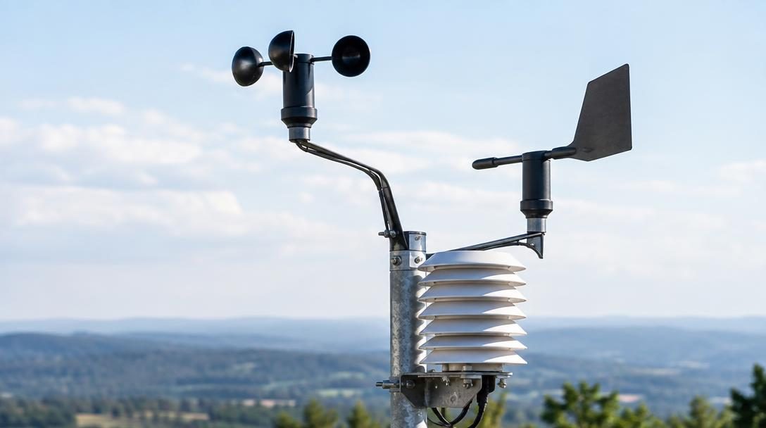
The window spanning roughly two to five days represents the standard threshold for actionable planning. Within this five-day period, atmospheric models perform consistently well, capturing broad temperature shifts and general precipitation boundaries. Meteorologists view the five-day window as the limit of dependable planning for major events, travel, and logistics.
Once a forecast extends out to 10 to 14 days, certainty drops precipitously. Two-week projections are essentially educated estimations derived from climatological records and long-range probability curves. If an unusual Arctic chill settles over an area, a 10-day outlook may predict mild conditions simply because the historical average for that calendar day is moderate, even if the cold air mass shows no physical sign of departing.
| Forecast Window | Primary Data Source | Expected Accuracy Level | Practical Application |
|---|---|---|---|
| 24 Hours | Real-time radar, satellite tracking, established fronts | Exceptionally High | Finalizing daily schedules, clothing choices, and outdoor commutes |
| 2 to 5 Days | Short-range dynamic supercomputer models | Reliable and Consistent | Scheduling weekend events, sporting matches, and domestic travel |
| 10 to 14 Days | Historical calendar data and long-range model algorithms | Low to Speculative | Broad seasonal awareness; not suitable for non-refundable plans |
Geography, topography, and the challenge of regional climates
Just as forecasting difficulty spikes over extended timelines, it also varies dramatically by geographic region. A forecast is only as stable as the physical landscape beneath it. Flat terrain, warm ocean currents, mountain barriers, and lake bodies all exert localized forces on passing air masses, producing stark contrasts in forecasting reliability across North America.
Expecting meteorologists to achieve absolute perfection ignores the natural volatility of chaotic systems. In sports betting, professional handicappers who achieve a 60 percent accuracy rate are considered exceptional and generate considerable profit. Weather forecasters routinely exceed that success rate on short-range horizons, yet they must navigate atmospheric systems that are infinitely more complex than a basketball game.
San Diego, California

- Climate type: Semi-arid coastal
- Forecasting predictability: Consistently high
- Dominant feature: Narrow year-round temperature variations
Predicting the weather in San Diego represents one of the most straightforward tasks in American meteorology. Positioned along the southern Pacific coast, the city enjoys steady maritime influences that keep conditions sunny and moderate throughout the year. Temperature swings remain confined to a narrow, predictable band, meaning sudden atmospheric disruptions are rare and computer models encounter few conflicting variables.
Detroit, Michigan

- Climate type: Humid continental
- Forecasting predictability: Moderate to fluctuating
- Dominant feature: Rapidly shifting seasonal storm tracks
Detroit presents a far more challenging forecasting environment due to its continental location and exposure to rapid seasonal shifts. Air masses from northern Canada collide with moisture moving up from the Gulf of Mexico, causing pressure systems to alter course quickly. Sudden temperature swings and localized precipitation bands mean that predictions in this region require constant model adjustments.

Kansas and the Great Plains

- Climate type: Temperate continental / Tornado Alley
- Forecasting predictability: Volatile during active weather cycles
- Dominant feature: Wide temperature swings across expansive flat terrain
The remarkably flat geography of Kansas offers virtually no natural obstacles to slow or redirect moving air masses. This open terrain allows bitter polar air and humid southern fronts to collide violently, causing sharp shifts in wind speeds, sudden drops in temperature, and severe atmospheric instability. As a central corridor in Tornado Alley, the state experiences volatile conditions where localized severe storms can develop within hours, making long-range forecasting inherently difficult.
A practical guide to reading and applying forecasts
To avoid ruined plans and unnecessary frustration, consumers should approach weather reports with an understanding of how data is calculated. Following these operational guidelines helps translate meteorological forecasts into practical everyday decisions.
- Rely on the five-day window for major plans: Treat any forecast beyond five days as an experimental outlook. Commit funds and confirm outdoor logistics only when the target date enters the five-day range, where model consensus stabilizes.
- Check the 24-hour update before setting out: Active fronts are clearly visible on satellite and radar within a single day. Reviewing the forecast the evening before or morning of an outing guarantees the highest possible accuracy.
- Account for regional geography: Adjust expectations based on your destination's topography. Expect reliable consistency in stable coastal areas like San Diego, but prepare for rapid variability in continental hubs like Detroit or flat plains like Kansas.
- Cross-check during unseasonable weather events: If your area is experiencing unusual cold or extreme heat, recognize that 10-day to 14-day models may artificially drift toward historical averages. Monitor daily updates to see if dynamic models confirm the trend.
- Look for multi-model consensus updates: Listen to whether your local forecaster notes that multiple computer models agree on a storm system's trajectory. When several independent simulations align, confidence in the prediction rises substantially.
Common misconceptions when interpreting weather reports
Misinterpreting weather reports often causes as much frustration as an outright forecasting error. Addressing several persistent myths can save time, money, and unnecessary annoyance:
- Treating two-week forecasts as firm guarantees: Committing non-refundable deposits to outdoor weddings, picnics, or sports outings based on a 14-day outlook routinely causes disappointment. Long-range projections serve as broad climate indicators rather than guaranteed weather schedules.
- Directing blame at the local meteorologist: Viewers frequently target local broadcast forecasters when an event is rained out. In reality, on-air meteorologists do not handcraft forecasts based on personal guesses; they translate multi-model calculations processed by government supercomputing infrastructure.
- Assuming equal accuracy across all geographic regions: Expecting the same level of predictability in the flat plains of Kansas as in the stable coastal climate of southern California overlooks the fundamental role that topography plays in atmospheric stability.
- Overlooking significant technological progress: Frustration over a missed rain shower causes many to forget that meteorological models are vastly superior to those used 10, 20, or 50 years ago. Computational power continues to reduce forecasting error margins every decade.
Frequently asked questions
Why are 10-day forecasts so often inaccurate?
Projections extending 10 to 14 days rely heavily on predictive algorithms and historical calendar data rather than formed atmospheric fronts. Because tiny initial atmospheric variations multiply over time, models struggle to pinpoint dynamic storms two weeks in advance.
How far in advance is a weather forecast truly reliable?
Meteorologists consider the five-day window to be the benchmark for dependable event planning. Within 24 hours, forecasts reach their peak reliability because storm systems and pressure boundaries are already formed and tracking across radar networks.
Do local meteorologists create forecasts entirely by themselves?
No. Broadcast meteorologists interpret data generated by sophisticated computer simulations, including Hewlett-Packard supercomputers operated by the National Weather Service. Their role is to synthesize multiple model outputs and communicate the consensus to the public.
Why is the weather harder to predict in some states than others?
Topography and regional climate dictate predictability. Flat states like Kansas allow winds and contrasting air masses to collide without geographic barriers, causing sudden severe weather, whereas coastal areas like San Diego experience consistent marine climates with minimal temperature variation.
How much has forecasting accuracy improved over time?
Forecasting reliability is substantially higher today than it was 10, 20, or 50 years ago. Sustained investments in supercomputing power, satellite tracking, and atmospheric data analysis have steadily narrowed error margins across both short- and medium-range outlooks.
The bottom line
Weather forecasting is a complex science that attempts to predict the movement of an ever-shifting global atmosphere. While people naturally crave certainty when planning work, travel, and recreation, atmospheric physics does not accommodate absolute guarantees weeks in advance. The supercomputers operated by organizations like the National Weather Service continue to add computational power, refining models and improving our daily foresight.
Rather than treating every television graphic as an unbreakable promise, savvy consumers view weather outlooks as tiered estimates. Rely on the 24-hour and five-day windows for concrete scheduling, treat long-range projections as broad historical guides, and remember that an unexpected shift in the clouds is a reminder of nature's inherent volatility rather than an individual forecaster's mistake.